Forest Service Encourages Visitors To Use Free Maps Before Heading Into The Woods
The U.S. Forest Service is reminding visitors to use free maps before heading into the woods, including Umpqua National Forest guides, Motor Vehicle Use Maps and digital tools that can help with trip planning and navigation.
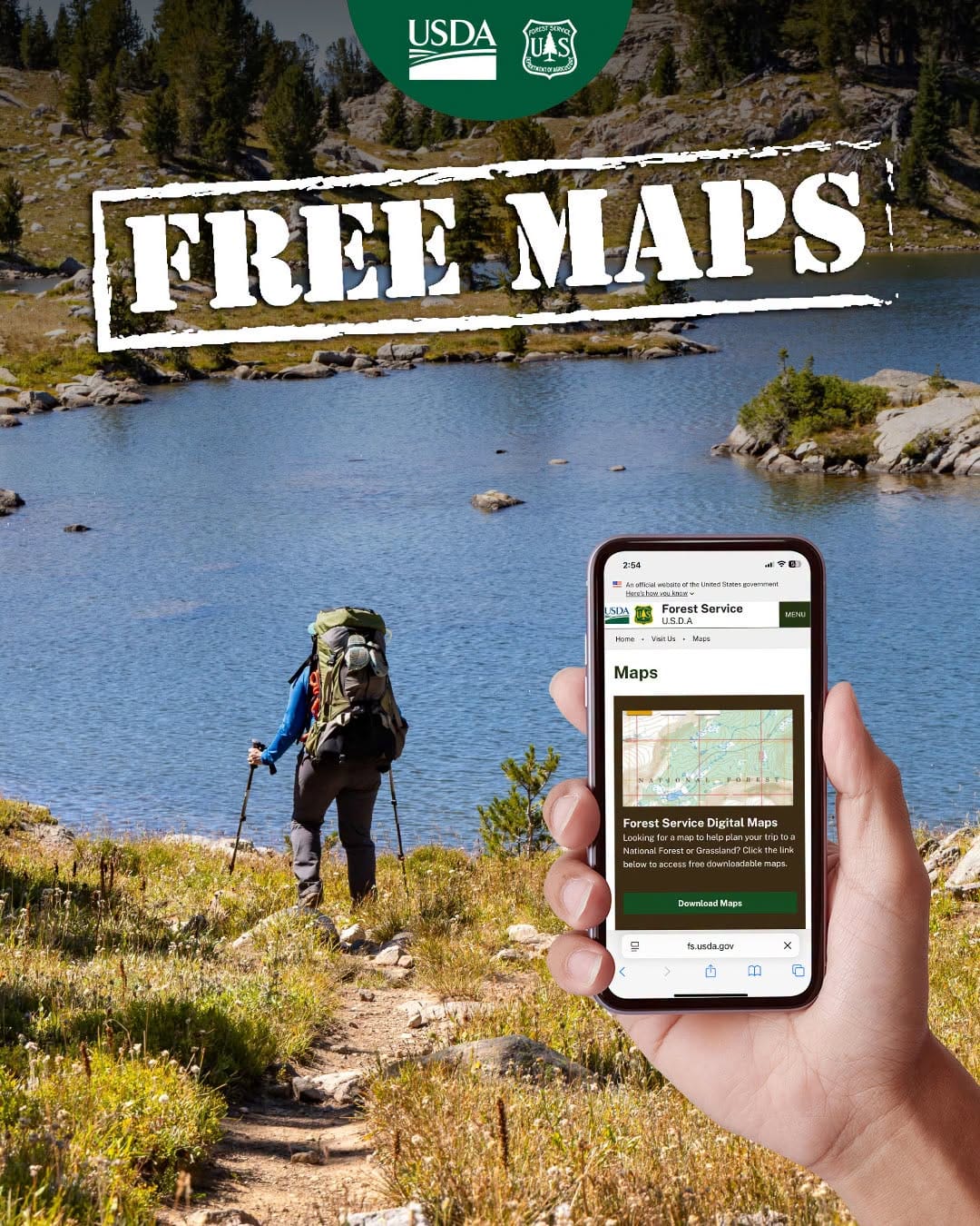
ROSEBURG, Ore. - Before heading into the woods this summer, the U.S. Forest Service is reminding visitors that a good map can make the difference between a smooth trip and a frustrating one.
The agency is pointing outdoor users to its free map resources, including the Forest Service’s main Maps page, which includes tools for planning trips to national forests and grasslands across the country.
For those staying closer to home, the Umpqua National Forest Visitor Maps and Guides page includes local resources for recreation planning, road access and backcountry navigation.
One of the most important tools for anyone driving forest roads is the Umpqua National Forest Motor Vehicle Use Map page. Motor Vehicle Use Maps, often called MVUMs, show which roads, trails and areas are open to motorized travel. The maps also show allowed vehicle classes, seasonal restrictions and other travel rules.
The Forest Service says only routes shown on the MVUM are open to public motor vehicle travel. Because the maps do not include full topographic detail, they are best used with a Forest Visitor Map or another detailed map when planning a trip.
Visitors can also use the Avenza Maps app information page for the Umpqua National Forest to download georeferenced maps to a smartphone. According to the Forest Service, those maps can work with GPS-enabled devices to show a user’s real-time location, even without cell service.
The Forest Service also offers an Interactive Visitor Map for exploring roads, trails, recreation sites, wilderness areas and other public lands information before leaving home.
Anyone planning to camp, hike, ride, hunt, drive forest roads or head into the backcountry is encouraged to download maps ahead of time, check current alerts and carry backup navigation. Cell service can be limited or unavailable in many forested areas.

Comments ()