Crater Lake Snowpack Falls Into Record-Low Territory, NWS Says
Crater Lake-area snowpack has fallen into record-low territory, according to the National Weather Service. Annie Springs SWE was at just 22% of its normal April peak on March 28, while snow depth at Crater Lake measured 17 inches, far below the 118-inch normal.
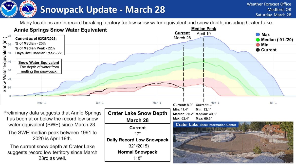
Snowpack conditions around Crater Lake have dropped into record-low territory, according to a March 28 update from the National Weather Service in Medford.
The update shows snow water equivalent, or SWE, at Annie Springs was at just 25% of the median for March 28 and 22% of the site’s typical April 19 peak. The graphic notes Annie Springs has been at or below record-low SWE levels since March 23.
Crater Lake snow depth is also running far below normal. As of March 28, snow depth at Crater Lake was listed at 17 inches. The daily record low snowpack for that date is 32 inches, set in 2015, while normal snowpack is 118 inches.
The National Weather Service said many locations are now in record-breaking territory for low snow water equivalent and snow depth, including Crater Lake.
Snow water equivalent measures how much water is contained in the snowpack and is a key indicator for water supply, runoff and fire-season concerns later in the year.
While the current numbers are unusually low, forecasters said more snow is expected in the Cascades in early April.

Comments ()